Photo Gallery
Some photos of what is discussed in this story
This photo series documents the development and physical interventions regarding the property's access conditions over a period of almost 50 years. Through aerial photography, private photos, and situational images, it illustrates how an established access road was systematically removed, and the subsequent struggle to have it restored in accordance with legally binding court decisions.
Click a photo to view it in full size. Use the arrows or swipe to browse through the gallery.
1968 – 2022
Aerial photos – the history of the access roade
The photo above is an aerial photograph from 1968 showing the access to the property at that time. As shown in the image, the building structure at that time was approximately half the size it is today. The northern part of the building, where the two apartments in the co-ownership are currently located, had not yet been constructed. Consequently, there is no established access road to the north in this photo. Although the image is somewhat blurred, it is evident that at that time, no drivable access to the building itself had been established at all. However, a car can be glimpsed on the far right of the image, either driving or parked along Strandvegen.
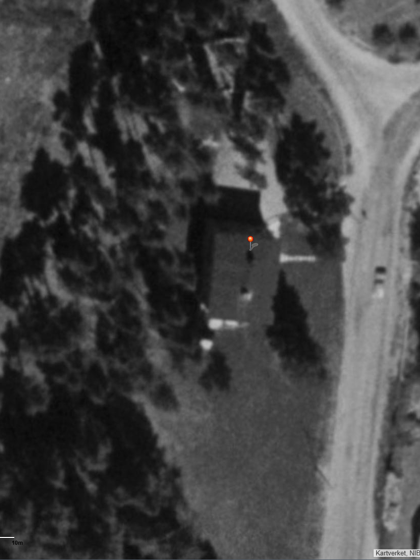
The photo above is an aerial photograph from 1980 showing the access to the property at that time. As shown in the photo, an access road had been established to the north leading to where the two residential sections in the co-ownership are located today. Note especially the car parked alongf the northern access road, which documents that the area was being used for both access and parking at that time. There was also access from the east leading to the entrance of the commercial section. There was no access road where the parking lot is located today.
The photo above is an aerial photograph from 2002 showing the access to the property at that time. As shown in the photo, there was an access road to the north leading to where the two residential sections in the co-ownership are located today. Note especially the car parked right against the house wall on the north side, which documents that the area was already being used for both access and parking at that time. There was also access from the east to the entrance of the commercial section, but there was still no access road where today's parking lot is located.
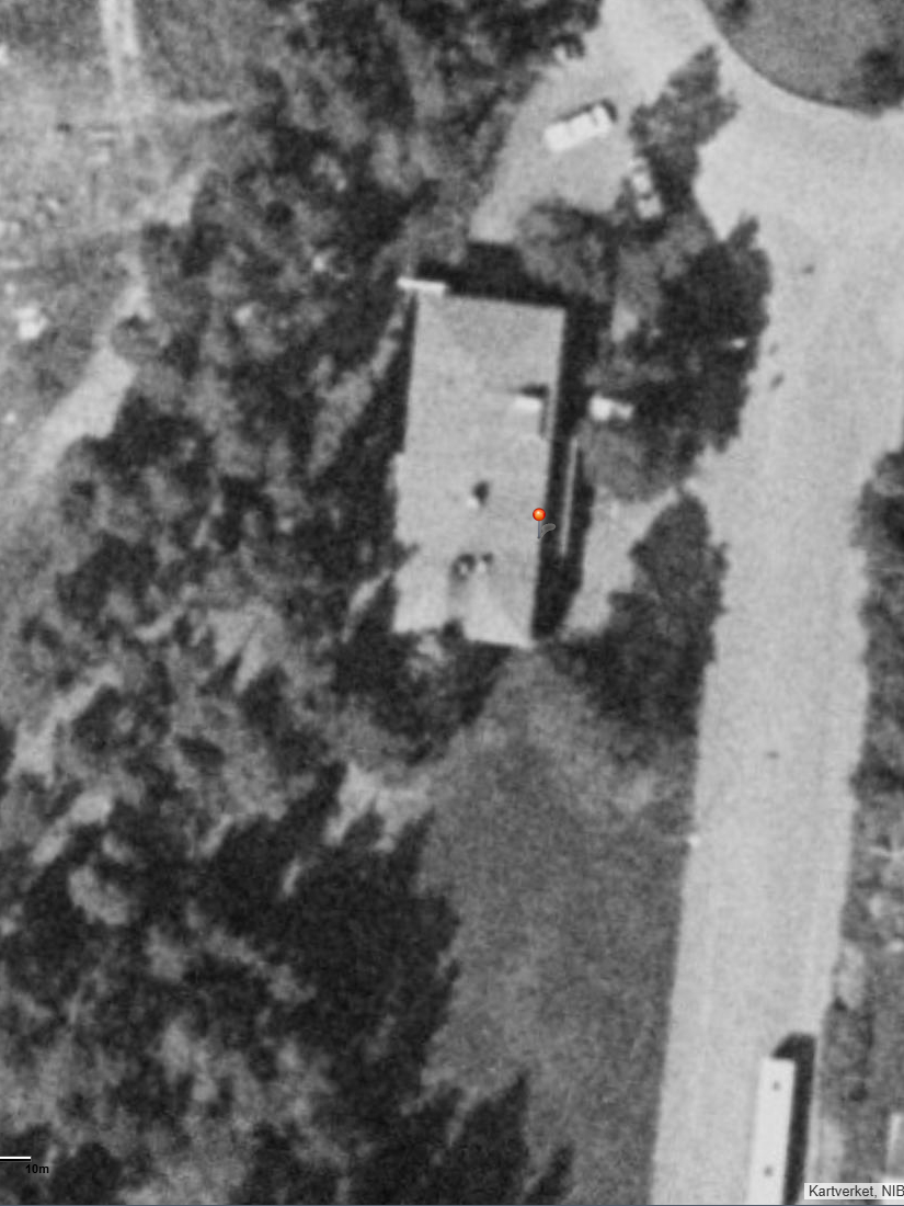
The photo above is an aerial photograph from 2007 showing the access to the property at that time. As shown in the photo, there was an access road to the north, where the two apartments in the co-ownership are located today, as well as from the east leading to the entrance of the commercial section. At this time, no access road had yet been established where today's parking lot is located.
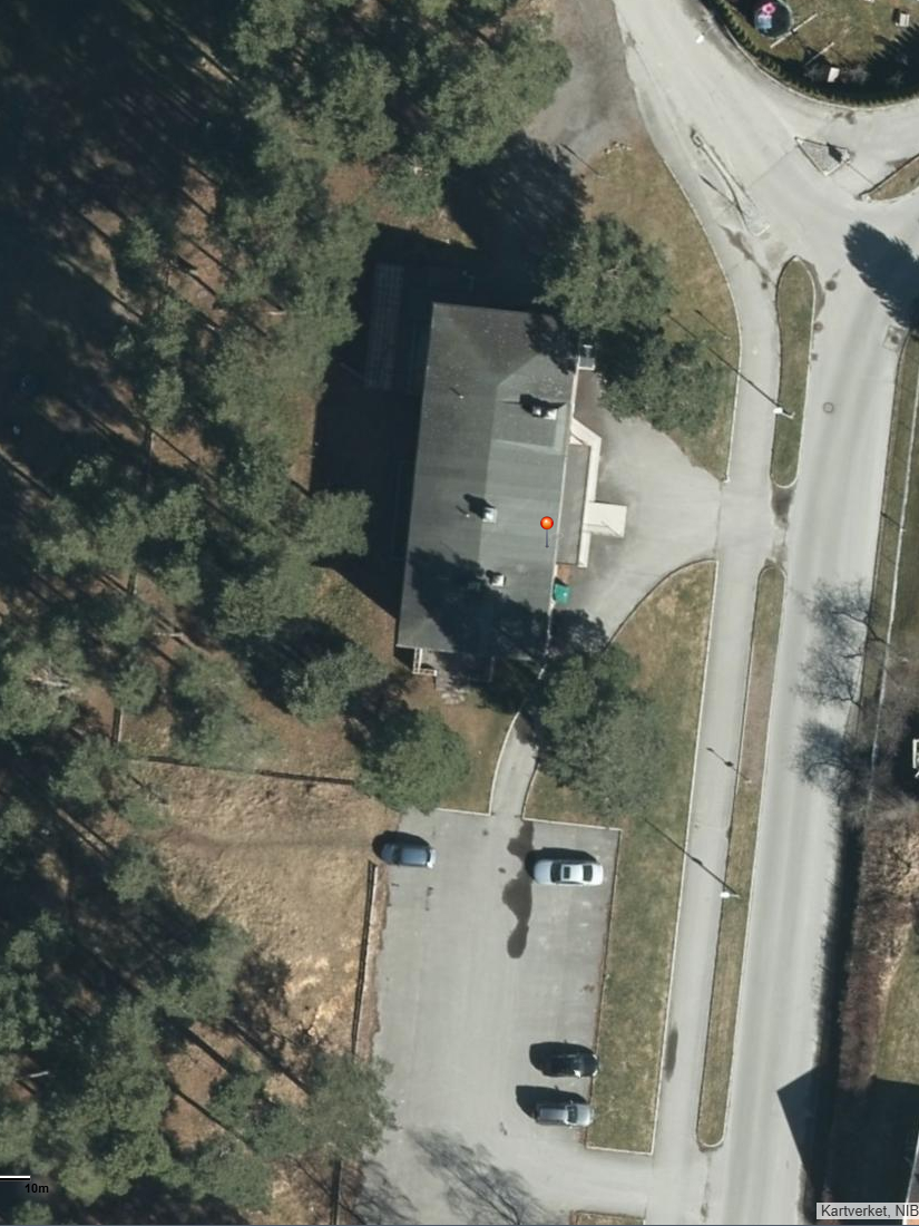
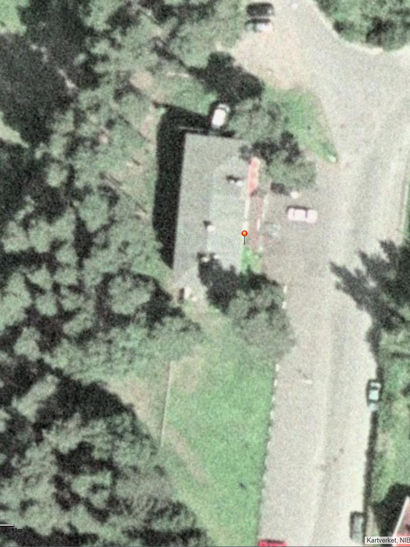
The photo above is an aerial photograph from 2016 showing the access to the property at that time. As shown in the photo, there is an access road to the north, where the two apartments in the co-ownership are now located, as well as from the east leading to the entrance of the commercial section. Access has now been established on the southern part of the property in connection with the parking lot at the south end of the property.
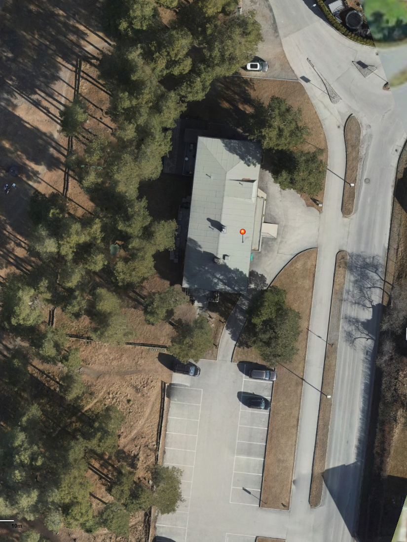
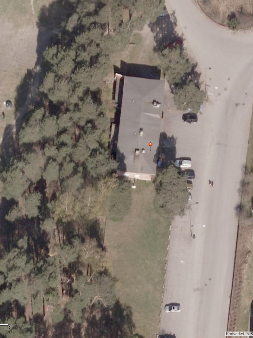
The photo above is an aerial photograph from 2022 showing that the northern access to the property has been removed, and that a lawn has been laid and blocked with curbstones to prevent vehicular access to the property from the north.
2013 – 2021
Parking signs – installation and vandalism
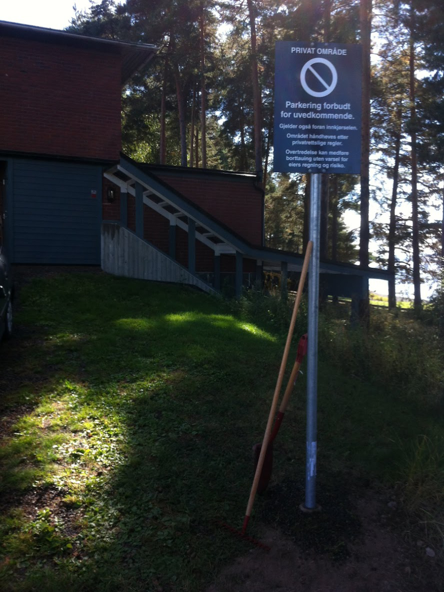
This photo shows one of the parking signs immediately after installation in the summer of 2013. As documented during the trial, there was full agreement within the co-ownership at that time that the signs should be put up. It was also decided that the two residential sections would jointly handle the installation and cover all associated costs. Ownership of the signs therefore belongs to the two residential sections jointly, and not to the co-ownership.
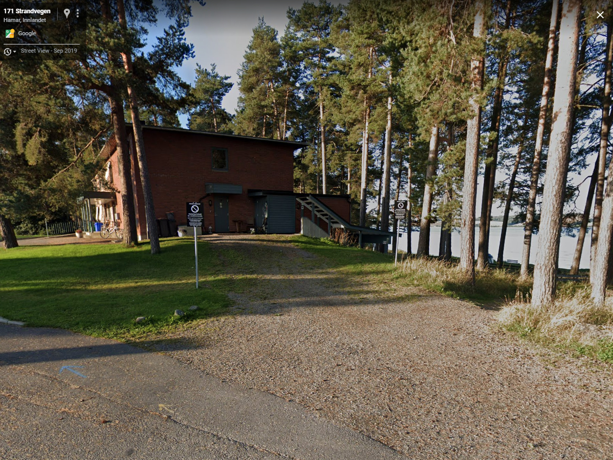
"This photo shows 'our' access road as it appeared in 2019. When we purchased our apartments in 2011, it was newly graveled and did not show signs of decay like it does here. However, this is how it became over time, as Hanne Sine Andresen, after taking over the commercial section of the co-ownership, has used her majority vote to neglect the maintenance of this access road.
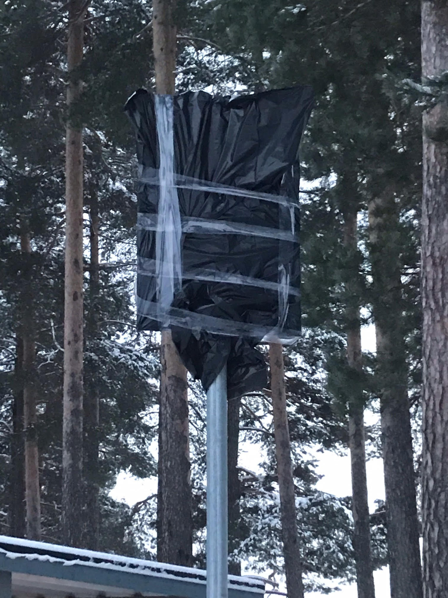
This photo shows how both signs looked on January 7, 2021. It is somewhat unclear exactly what the deeper meaning behind this was, but as a form of harassment, it certainly served its purpose!
June 24th 2021
Vandalism – the signs are removed with an angle grinder
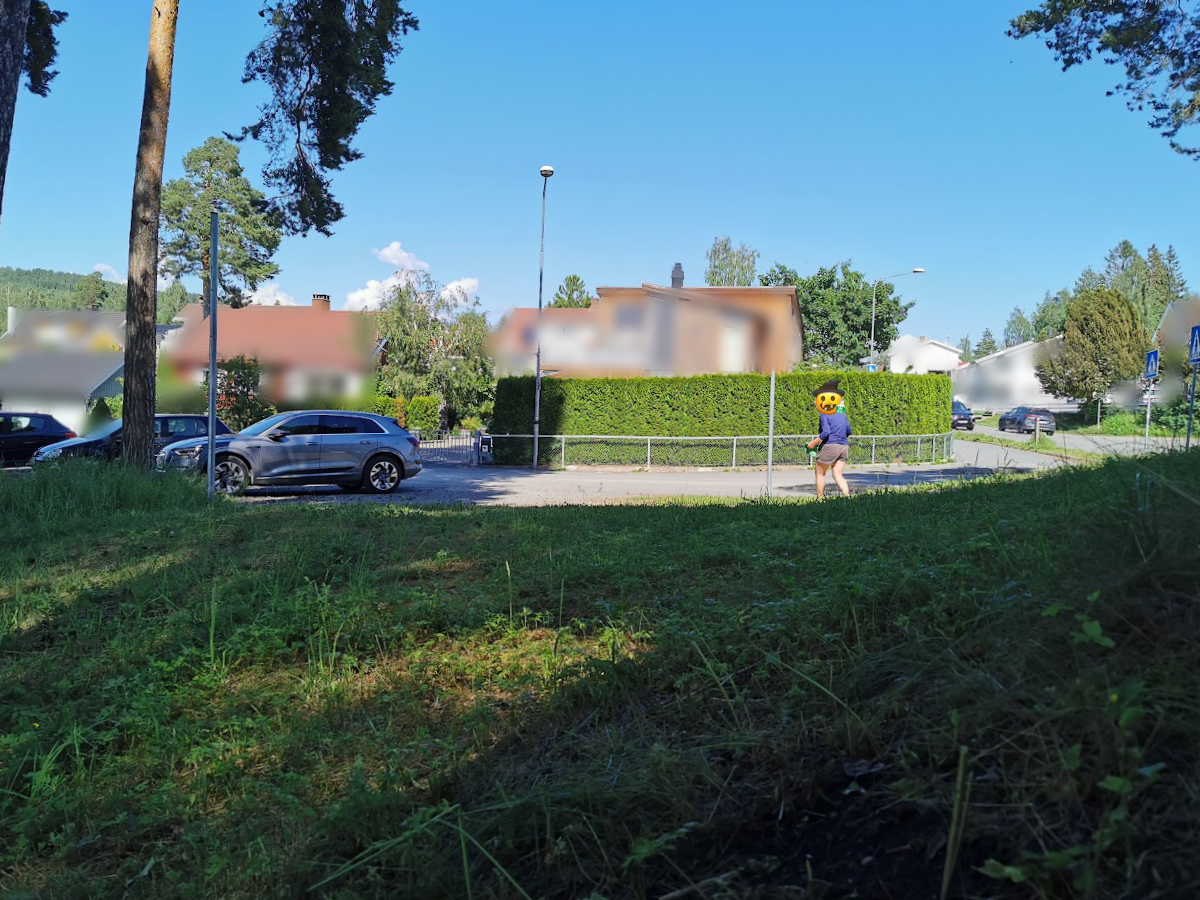
This photo shows Hanne Sine Andresen 'in action' on June 24th, 2021, right after her 'friend' from that time had cut down the sign plates with an angle grinder. I have no photos of that exact moment, as I was literally at my breaking point. I had to go for a walk along the beach to avoid ending up in the same place with a baseball bat in hand...

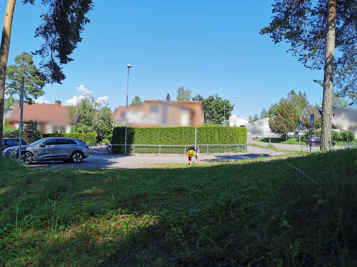
This photo shows Hanne Sine Andresen in the same situation, still on June 24th, 2021. I am unsure what the green item in her hands is, or what she intends to do with it. Perhaps she is harvesting ingredients for 'something'? 😀
Yet another photo from the same situation, also taken on June 24, 2021. It almost looks as if Hanne Sine Andresen is attempting to dig up the sign foundation here. Regardless, she did not succeed, as that was only accomplished by the contractor she hired to completely remove the access road a few days later.
This photo shows how 'someone' has blocked 'our' access road by putting up a chain between the two sign posts remaining after Hanne Sine Andresen, with the help of her 'friend' from that time, had committed vandalism. Because that is indeed what it is called when someone takes the law into their own hands and deliberately destroys someone else's property. All of this took place on June 24, 2021.
June 28th – September 6th 2021
The access road is removed
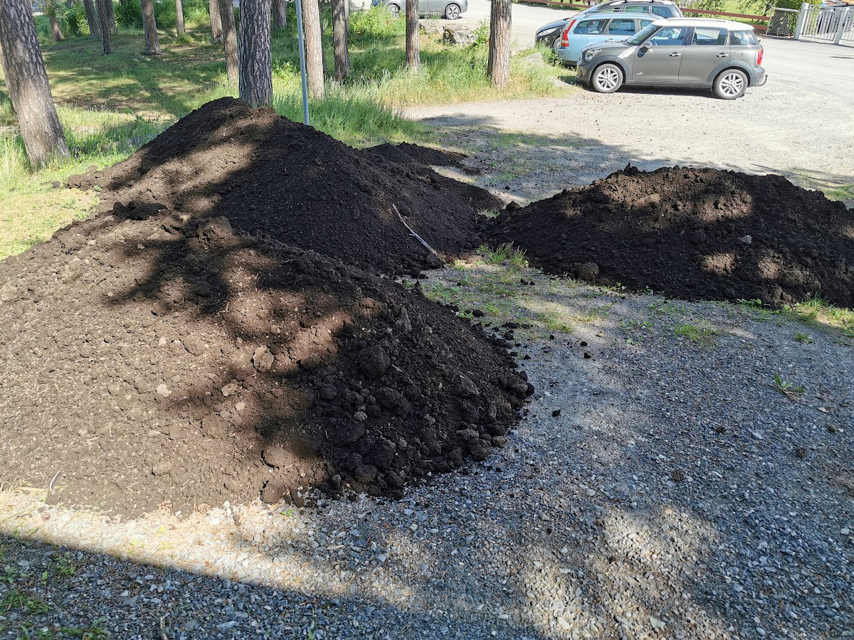
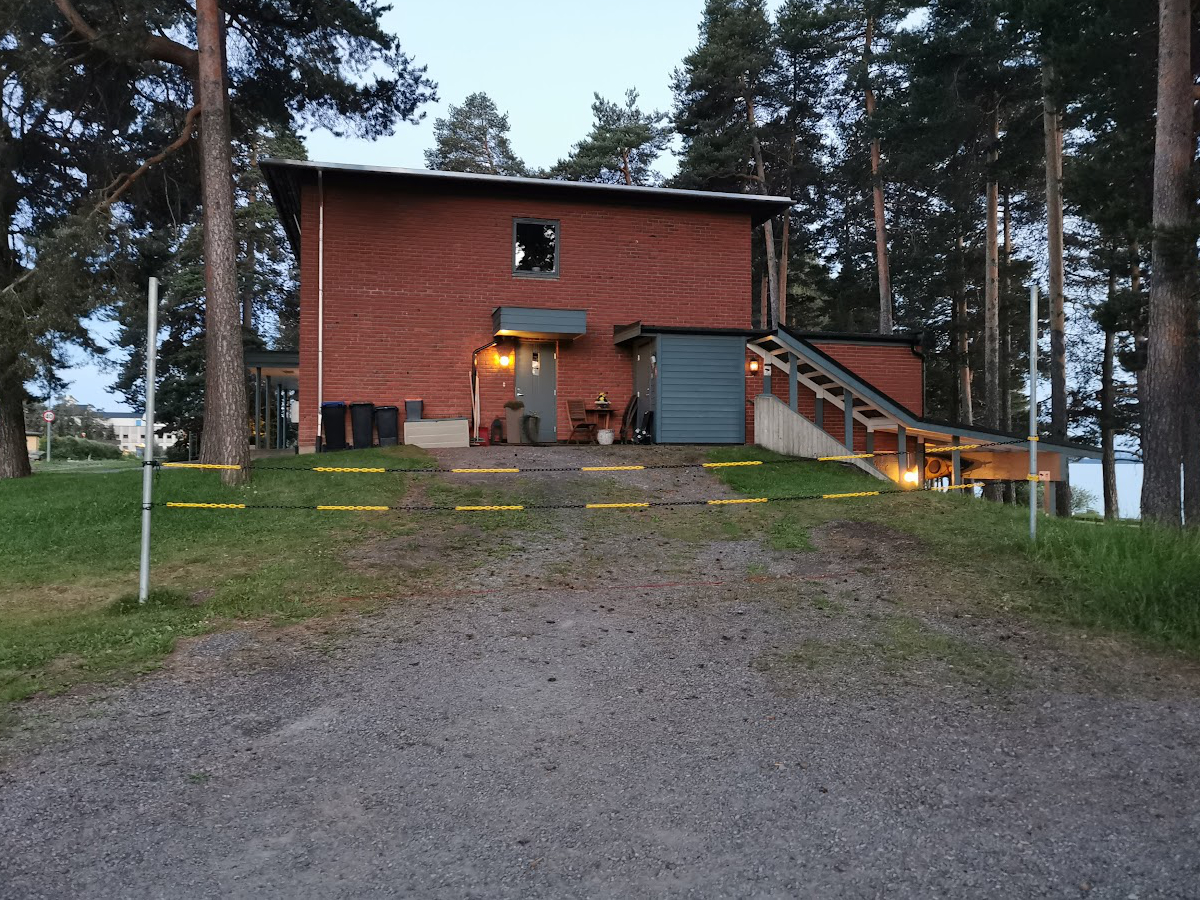
Here, we were to be harassed further, as 'someone' had blocked 'our' access road with several loads of soil. The photo was taken on June 28, 2021. It is not exactly difficult to guess who had this done, even though I did not witness it being done myself.
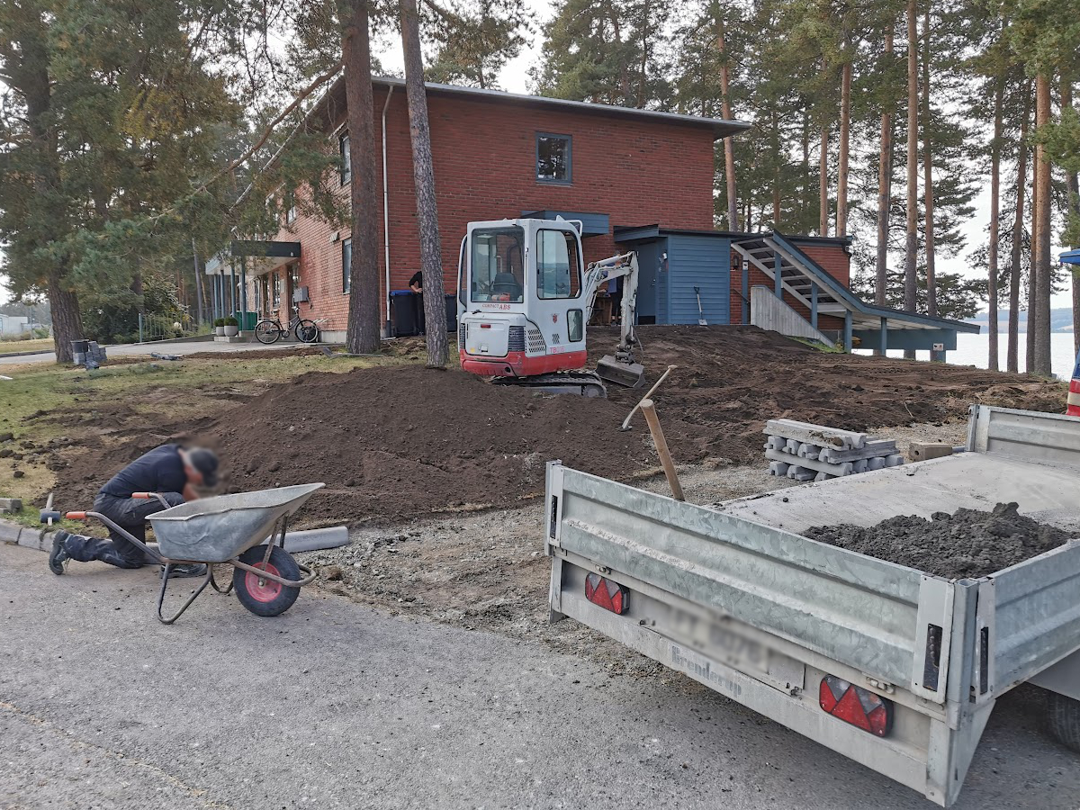
Then comes the day when a contractor removes 'our' access road and replaces it with a lawn and curbstones, naturally commissioned by Hanne Sine Andresen, who 'hid' behind a tree when I took this photo. She even had the nerve to serve coffee and baked goods to the contractor using my good neighbor’s entrance landing as a serving table. When we were also forced to help pay for this, as the costs were subsequently charged to the co-ownership, the violation was complete. The photo was taken on September 6th, 2021.
On the far left of the photo, we can see the contractor carrying away the foundation for one of the sign posts after digging it up. In the middle of the photo we see Hanne Sine Andresen inspecting the work she has started. She was probably happy at the time, but I'm not sure if she is as happy at the time of writing this. The photo was taken on September 6th 2021.
April 2024
A form of contempt of court becomes visible
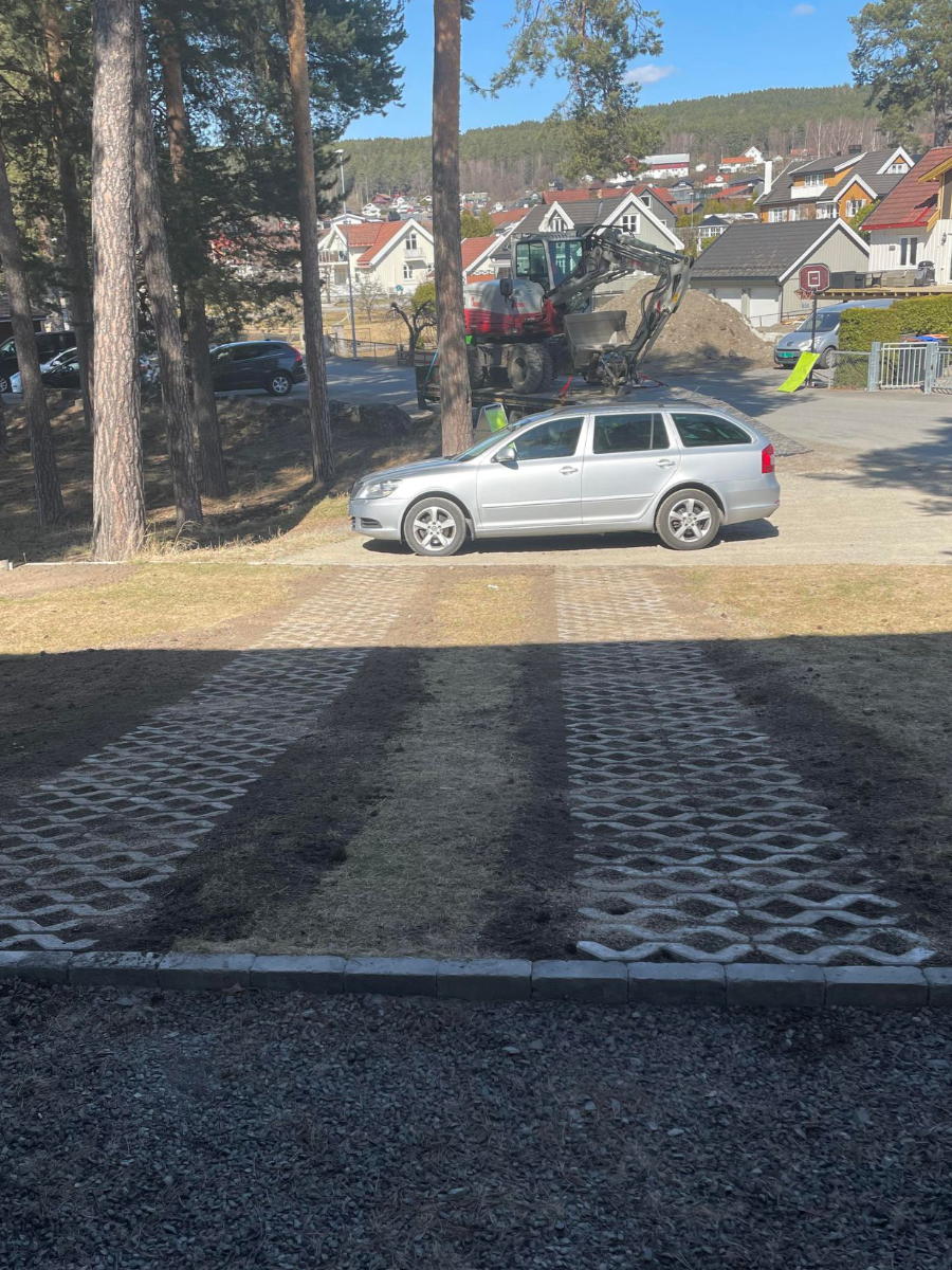
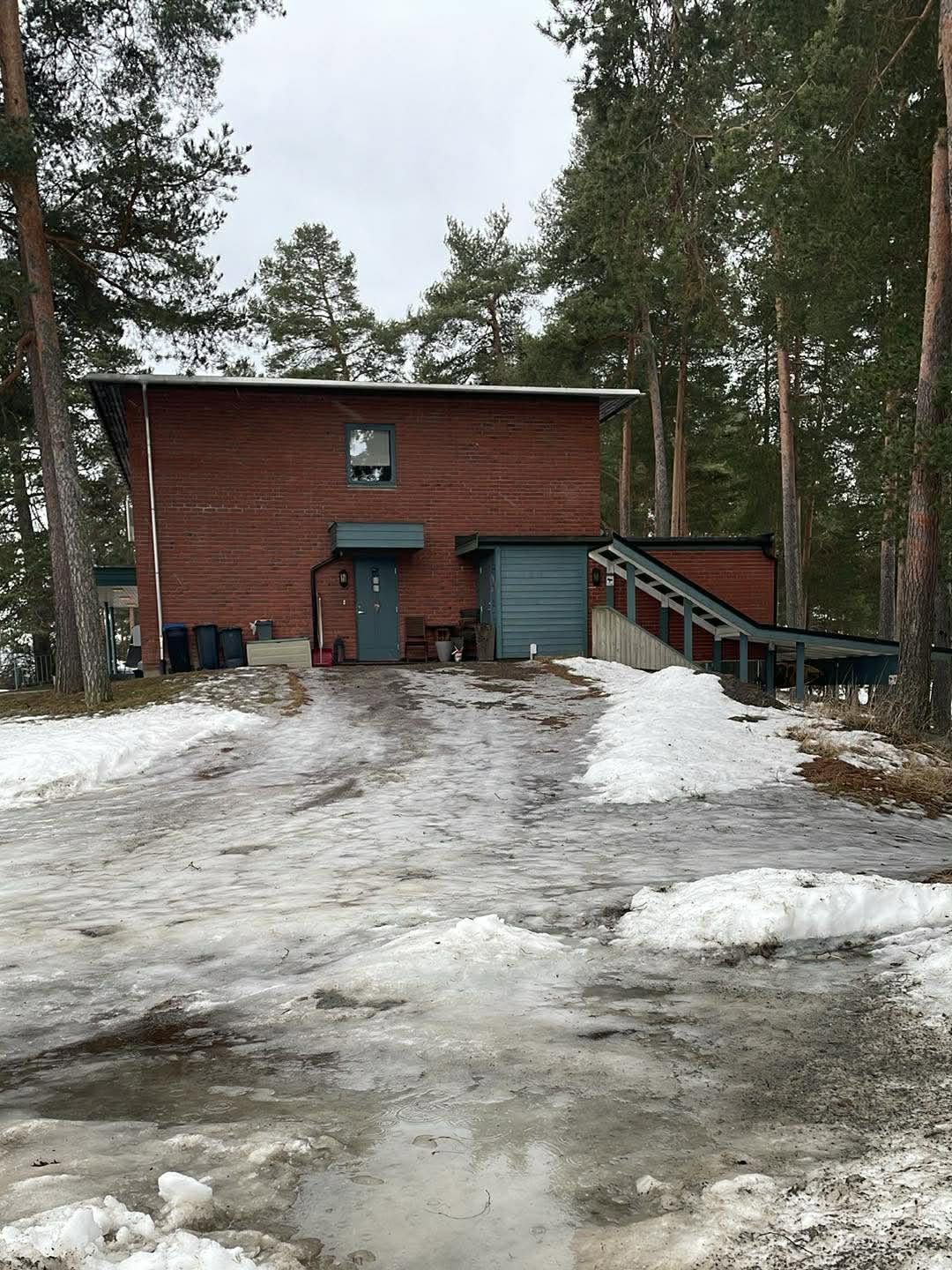
This photo shows how Hanne Sine Andresen chose to 'restore' 'our' access road. As seen in the image, she has chosen to lay a form of 'grass reinforcement' as two 'wheel tracks,' making it somewhat possible to drive across the lawn to our entrance areas. However, this is by no means a proper access road, and there are still curbstones in front of the 'access road' - if you can even call it that. She simply refused to put the parking signs back up. The court judgment, which was final and enforceable at this point, was crystal clear that the access road was to be restored and the parking signs reinstalled. This was a direct court order, so one really has to wonder why she chose to ignore it entirely. The photo was taken on April 23rd, 2024.
September 2024
The access road is restored
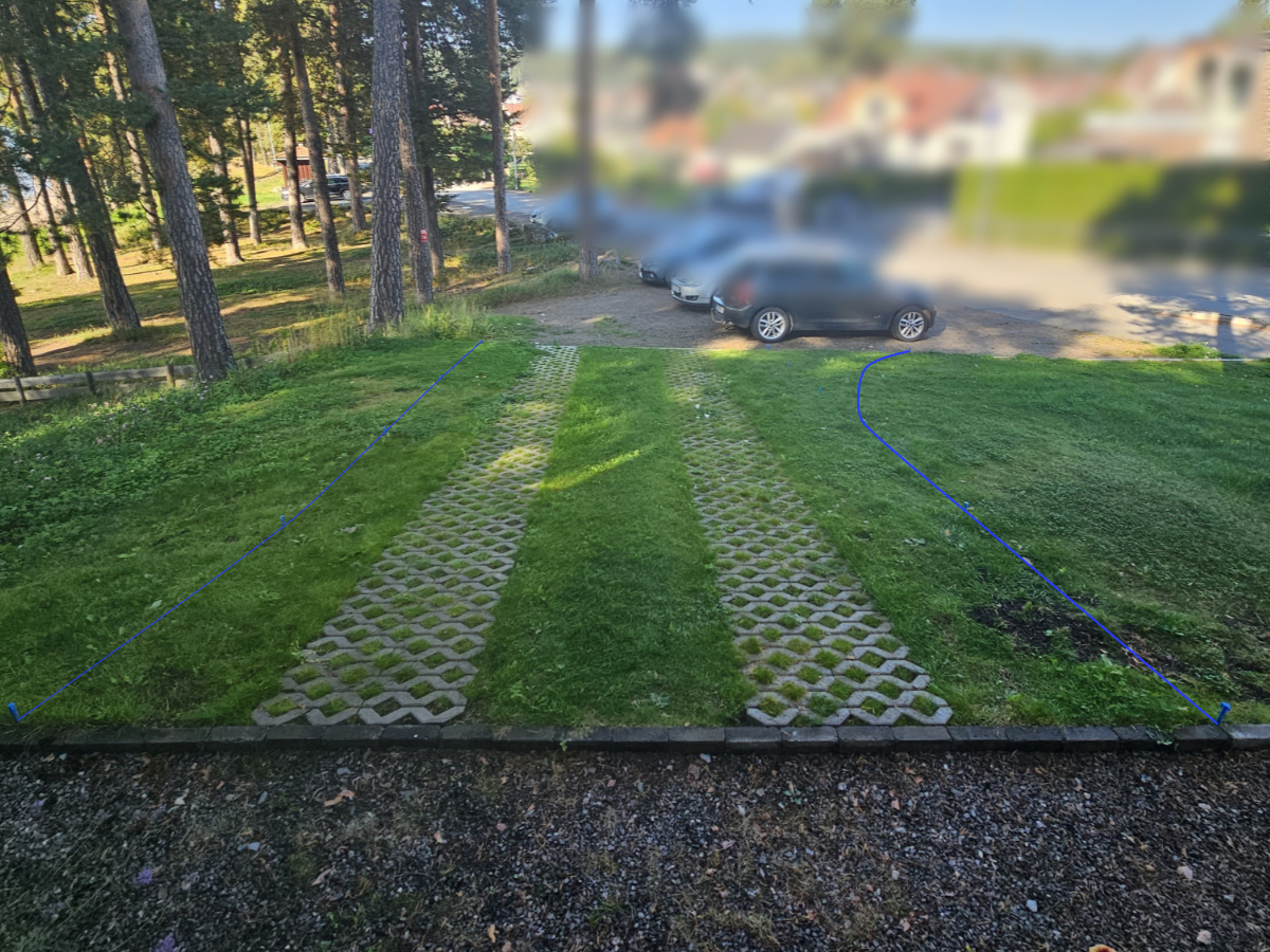
Here I've marked how the access road will run when it's soon to be restored. I've used tent pegs to mark the road route. Since these are not very visible in the image, I have marked the road route with blue lines in the image. The photo was taken on September 5th 2024.
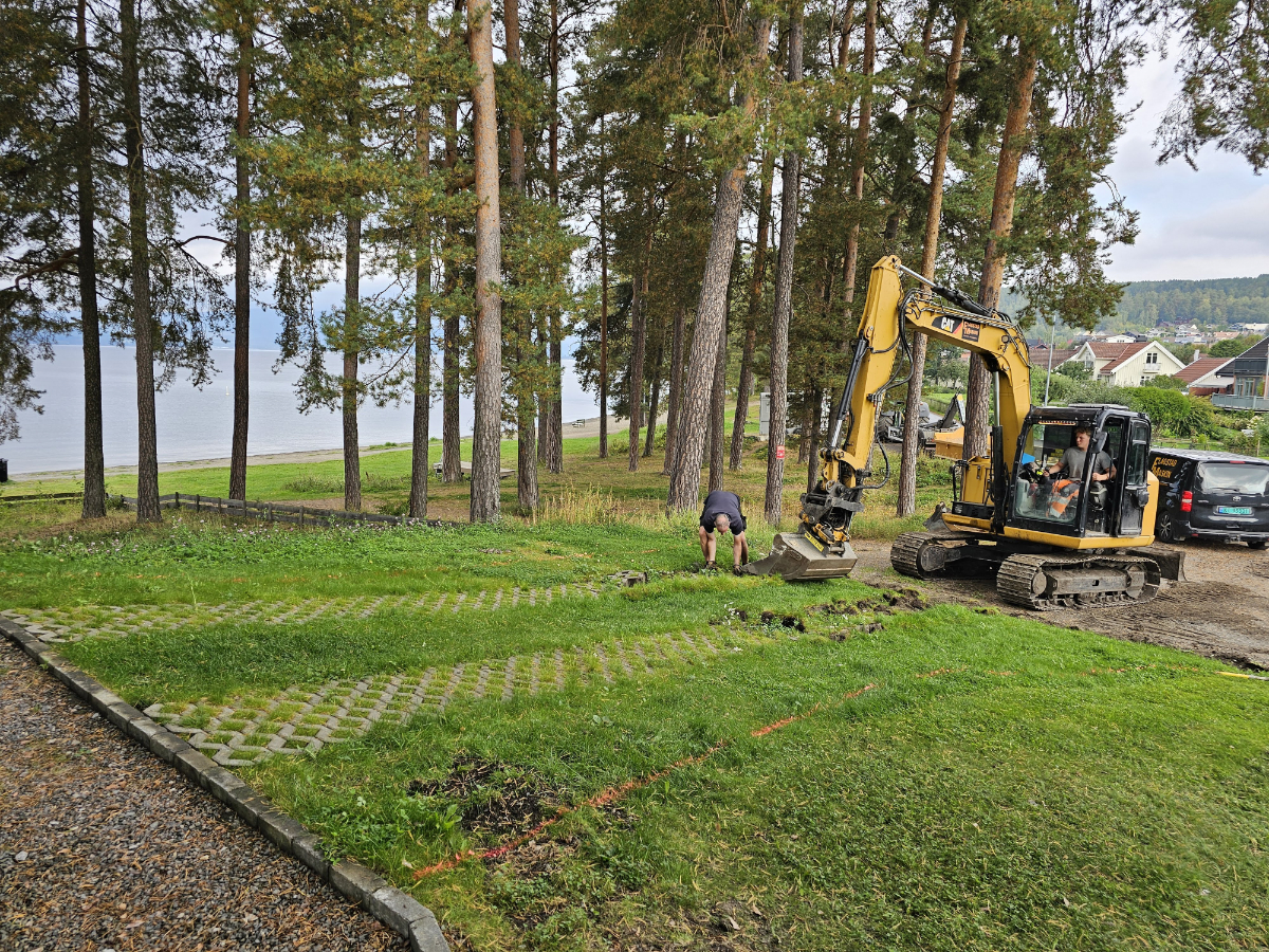
The first thing that was done was that the 'wheel tracks' or 'grass reinforcement' were removed and stacked on a pallet. This weighed nearly 2 tons, so moving that pallet afterward won't be an easy task - but that's not going to be my problem. The photo was taken on September 9th, 2024.
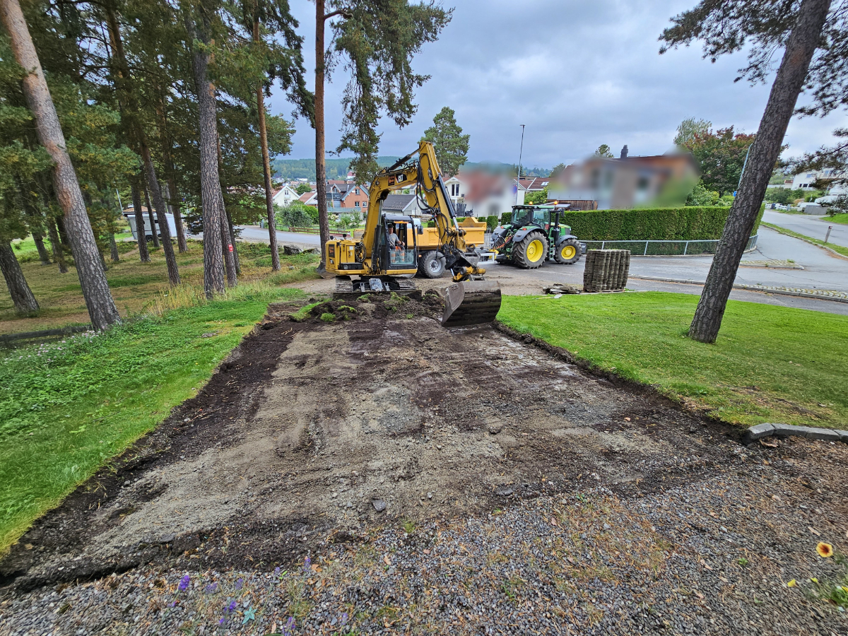
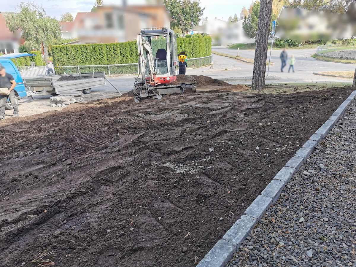
Here, soil and other materials are being removed. We had to dig down about 20 cm before reaching gravel and stone. In total, approximately 12 m³ of material was removed. The photo was taken on September 9th, 2024.
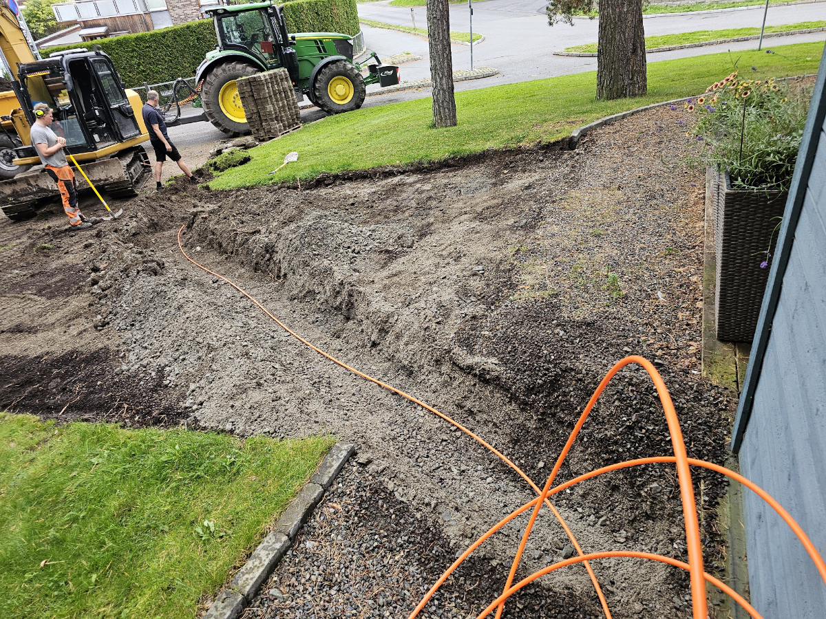
hile we were already digging in the area, I took the opportunity to lay a conduit for a fiber optic cable all the way to the house wall. The photo was taken on September 9th 2024.
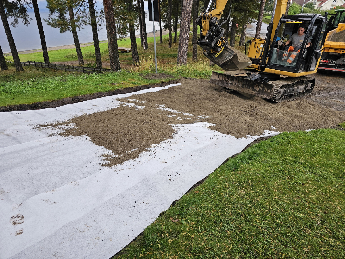
Here we can see that an geotextile membrane has been laid across the entire roadbed to prevent weeds from growing up from below. The photo was taken on September 9th 2024.
Here we can see that they are almost finished laying the road gravel. We chose road gravel as it was recommended over the the gravel more commonly used for such driveways. We were told that road gravel compacts harder and doesn't disappear as easily as other gravel can, especially important since the access road is on a slope. The photo was taken on September 9th 2024.
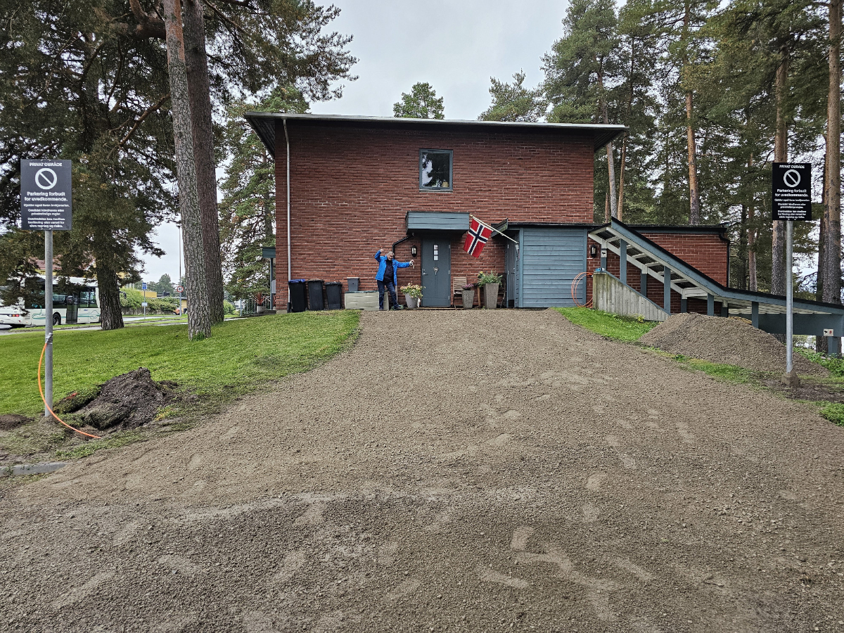
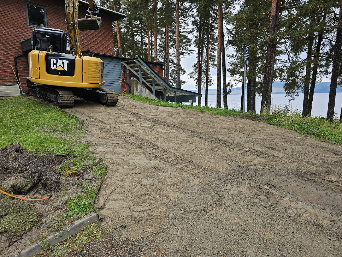
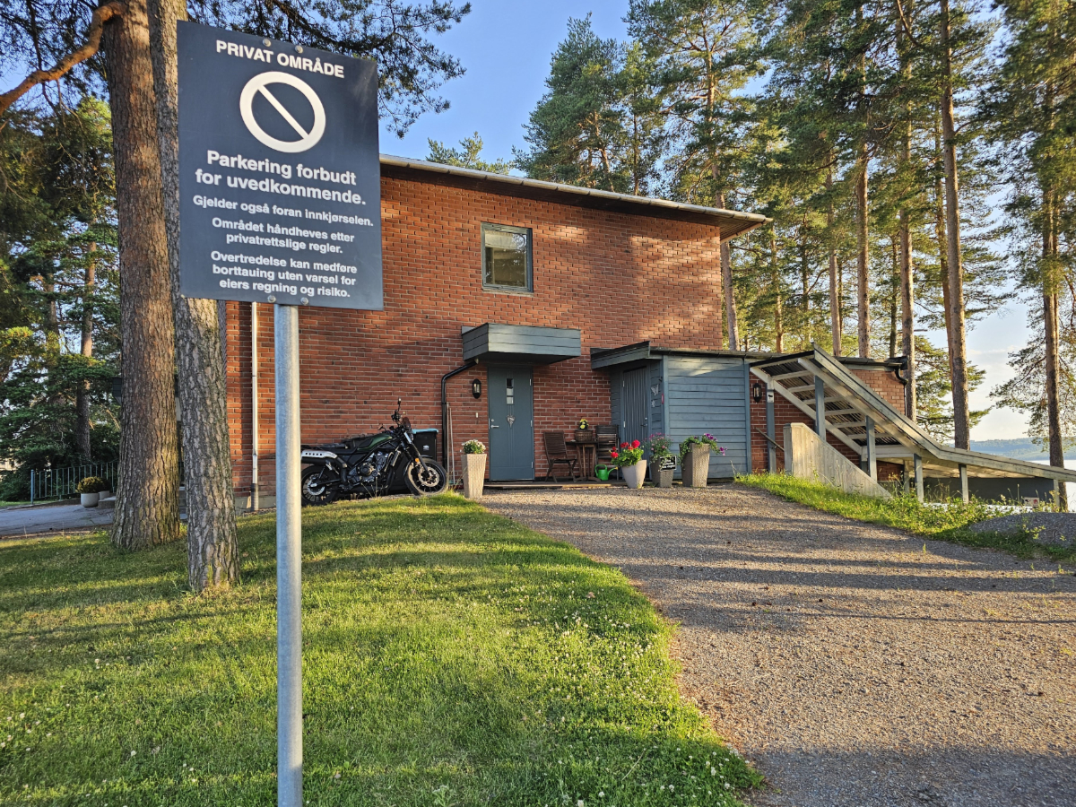
Here you can see what it looks like right after the contractor finished. It's been exactly three years and three days since the road was taken from us, so we thought it was appropriate to raise the flag now that it's finally back. Additionally, the parking signs has been restored to their original positions. The photo was taken on September 9th 2024.
October 2025 – March 2026
Another act of vandalism – in direct defiance of a final and enforceable judgment
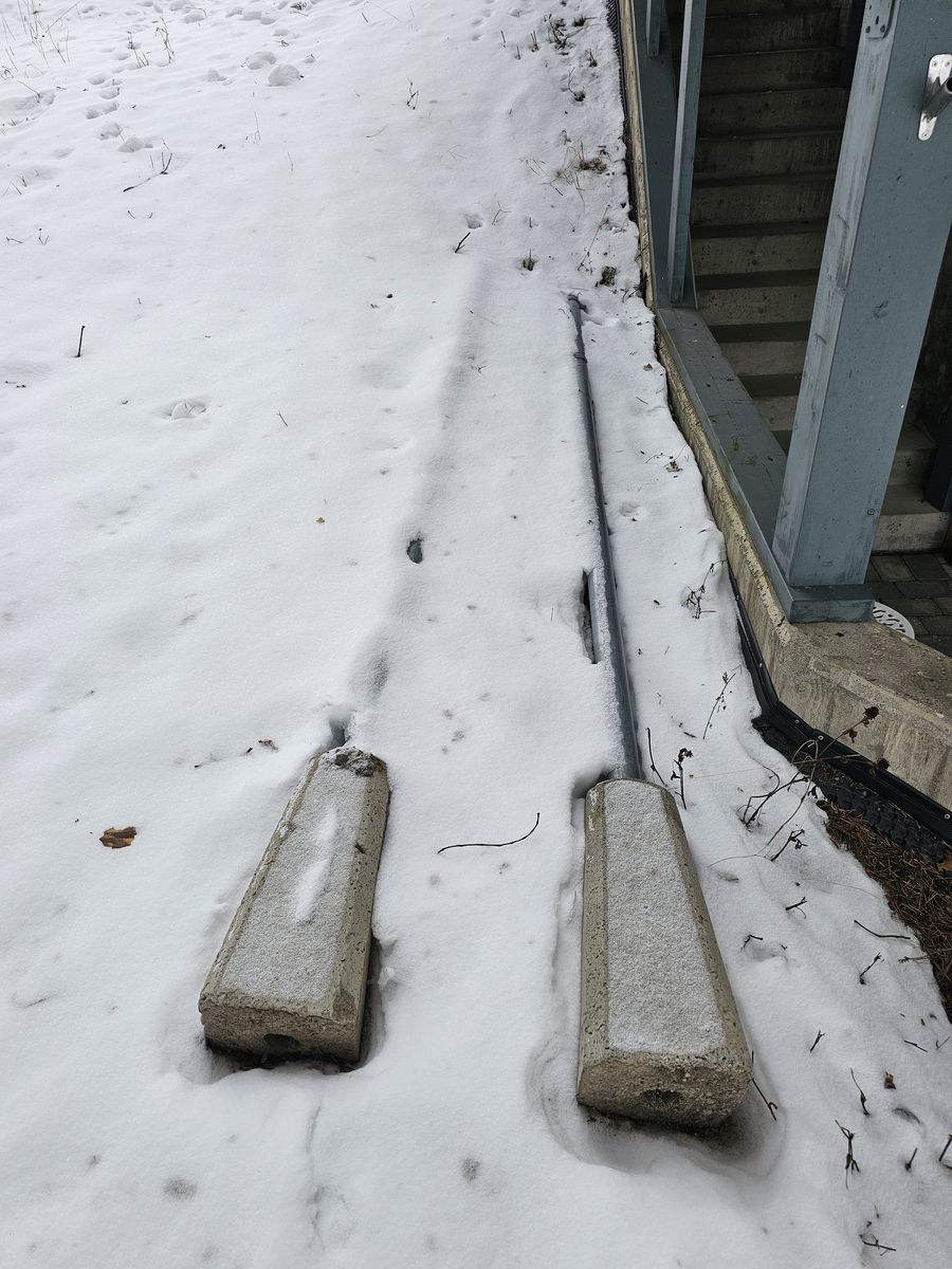
It is a sad sight: the parking signs lie on the ground, covered in snow, after Hanne Sine Andresen once again vandalised them and removed them, in direct contravention of a legally binding judgment that has been upheld all the way to the Supreme Court of Norway. The photo was taken on January 20th 2026.
Here we can see the state of affairs following yet another act of vandalism by Hanne Sine Andresen; as the photograph shows, she has once again removed the parking signs, in direct contravention of a legally binding judgment that has been upheld all the way to the Supreme Court of Norway. The photograph was taken on March 11th 2026.
July 2026
The parking signs are being re-installed, for the third time!
Then it was time to carry out the enforcement of the judgment once again, and to put up the parking signs for the third time. Here, the left sign is finished being re-installed. The picture was taken on July 10th, 2026.
Then it was time to carry out the enforcement of the judgment once again, and to put up the parking signs for the third time. Here, the right sign is finished being re-installed. The picture was taken on July 10th, 2026.